 Mobile Atlas Creator 1.9.12
MOBAC - (Open Source)
Create offline atlases from online maps for the favorite mobile navigation program with this useful software named Mobile Atlas Creator.
Mobile Atlas Creator is a powerful application that allows to create and edit maps for GPS (Garmin, Magellan and others), PC or and cell phone applications like TrekBuddy, AndNav and other Android, iPhone and Windows Mobile based applications. The application supports multiple resolutions of maps and different zoom levels, from multiple online sources. Simply drag and drop the maps to assemble, save as "Profile" and export as an image (JPG or PNG).
As source for an offline atlas Mobile Atlas Creator can use a large number of different online maps such as OpenStreetMap and other online map providers.
Create offline atlases for a large number of different (mobile) applications and GPS handhelds: AFTrack (Symbian), AlpineQuest (Android), AndNav (Android), BackCountry Navigator (Android), Big Planet Tracks SQLite format (Android), CacheBox (Windows Mobile), Cachewolf, Galileo Offline Maps (iOS), Garmin Custom Map - KMZ (GPS handhelds), Glopus (Pocket PC), Google Earth, GPS Sport Tracker, Magellan RMP (GPS handhelds) & VantagePoint, Maplorer (Windows CE/Windows Mobile), Maverick (Android), Mobile Trail Explorer (J2ME) - single tiles and MTECache file, NaviComputer (Windows Mobile), nfComPass (WinCE, WinMobile, WinXP), OruxMaps (Android), OsmAnd, Osmdroid (Android), OSMtracker (Windows Mobile/Pocket PC), OziExplorer (single 24bit PNG image with calibration (MAP) file, PathAway (Windows Mobile), RMaps SQLite (Android), [Nokia] Sports Tracker, Touratech QV (Windows software, commercial), TrekBuddy (J2ME, Android), TwoNav / CompeGPS, u-blox and others.
The application offers full support for network connections via HTTP proxy.
- Title:
- Mobile Atlas Creator 1.9.12
- File Size:
- 6.0 MB
- Requirements:
- Windows (All Versions)
- Language:
- en-us
- License:
- Open Source
- Date Added:
- 18 Apr 2013
- Publisher:
- MOBAC
- Homepage:
- http://www.mobac.sourceforge.net
- MD5 Checksum:
- 92A97677F2BFC9EC4130558EE3B3FE99
- Mapsource OpenStreetMap Maps4u.eu updated
- Reduced the number of decimal places of coordinates in GPX files created by MOBAC to 5 places
- Custom multi-layer map sources: Each layer can now have an alpha transparency value, specified as space separated list in <layersAlpha> element
- Bufix of conversion between different coordinate formats (degree, deg/min, deg/min/sec)
- localImageFile support using <retinaDisplay>
- More atlas format support retina (scale = 2) images, including Paper(PNG), Paper(pdf).
- More atlas format can display retina (scale = 2) images correctly (convert to scale = 1), such as iPhone v5
- Add <localImageFile> map source support
- Bug fix of 512x512 map tile images in Multiple layer
- Multiple language for Simplify-Chinese, Traditional Chinese and English
- View 512x512 map tile images for retina display
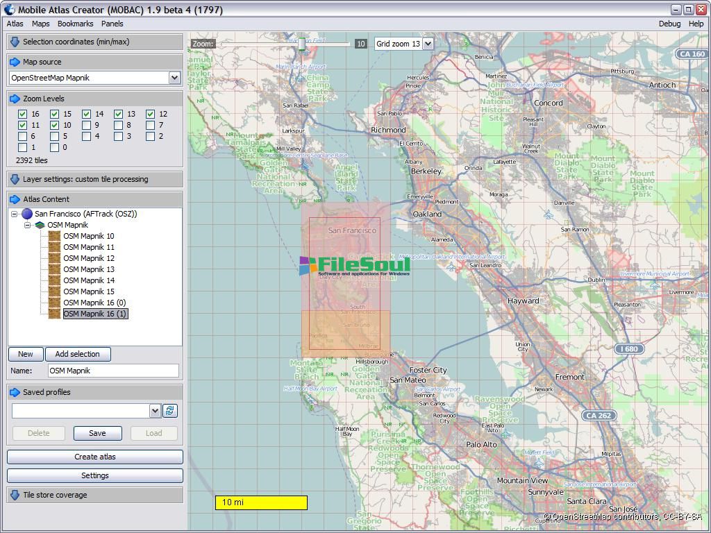
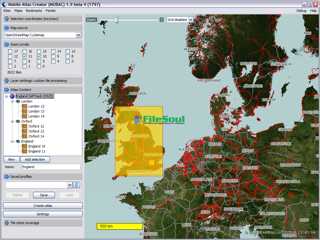
Screenshots
Related software
4.2/5 from 49 users