 Google Earth 5.1.3534
Google - (Freeware)
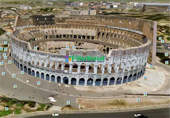
View 3D Earth, 3D representations of monuments, buildings, stars and satellites or just study the interactive globe with the amazing application called Google Earth.
Google Earth is a virtual globe that can be used to view the images recorded by satellite from most places in the world.
By entering the place to visit in the search, the application leads the user from space or a few meters above the ground, directly to destination. The accuracy of the photos is amazing.
Globe handling is very intuitive, being possible to orient the camera to rotate, move and naturally enlarge the image.
Additional information can be overlaid on the satellite image, such as hotels, restaurants, roads, etc.
Google Earth is entirely in 3D, relief areas (land and sea) and the buildings are also apparent.
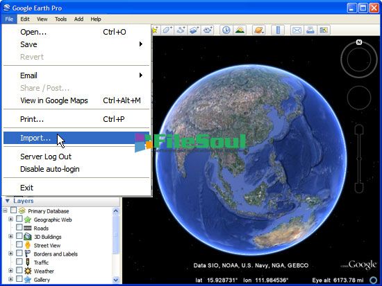
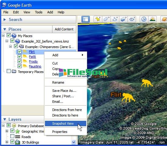
It is possible to annotate the map, send a satellite photo by e-mail or to make measurements to the nearest centimeter. Google Earth is now linked to Google Maps with a single click and user can also vary the lighting of a place based on time.
The application offers the possibility to connect a GPS to view the route and take advantage of specific data such as elevations, speed, etc.
- Title:
- Google Earth 5.1.3534
- File Size:
- 14.8 MB
- Requirements:
- Windows 2000 / XP / Vista / Windows7 / XP64 / Vista64 / Windows7 64 / Windows8 / Windows8 64
- Language:
- en-us
- License:
- Freeware
- Date Added:
- 18 Apr 2010
- Publisher:
- Homepage:
- http://www.google.com
- MD5 Checksum:
- 45A0E3F782BE9001480AF35269D191C7
* Improved embedded browser functionality:
- Better integration of embedded browser with Google Earth Application.
* Track and Multitrack in Google Earth:
- A track allows you to create one visible object in Google Earth (either a Point icon or a Model) that moves over time between multiple positions. Using the time slider, you can animate position and orientation of an object and show a line tracing the path. A multitrack is a collection of tracks. You can create Track and Multitrack by authoring KML documents or by importing your GPS data (from a number of GPS receivers or file formats such as GPX) into Google Earth.
* Elevation Profile in Google Earth:
- You can see elevation profile of a line-string or track in Google Earth. It plots the elevation profile, speed, and associated extended data (for example, heart rate) in a KML file.
* Added file import types:
- NMEA (.log and .nmea), Garmin GDB, Garmin Training Center, and Ozi Explorer files can now all be read. Garmin fitness extensions are now read from GPX. Extended data for Elevation Profile and Track is handled when available.
Screenshots
Related software
4.8/5 from 62 users