 Google Earth 6.0.2.2074
Google - (Freeware)
View 3D Earth, 3D representations of monuments, buildings, stars and satellites or just study the interactive globe with the amazing application called Google Earth.
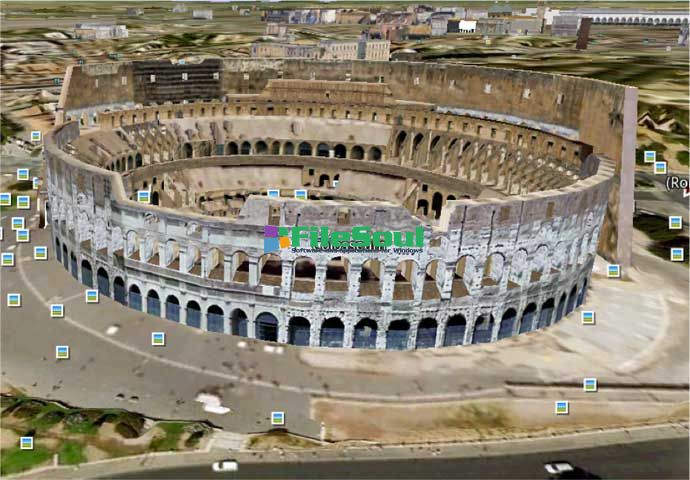
Google Earth is a virtual globe that can be used to view the images recorded by satellite from most places in the world.
By entering the place to visit in the search, the application leads the user from space or a few meters above the ground, directly to destination. The accuracy of the photos is amazing.
Globe handling is very intuitive, being possible to orient the camera to rotate, move and naturally enlarge the image.
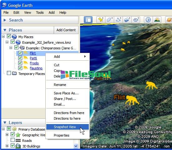
Additional information can be overlaid on the satellite image, such as hotels, restaurants, roads, etc.
Google Earth is entirely in 3D, relief areas (land and sea) and the buildings are also apparent.
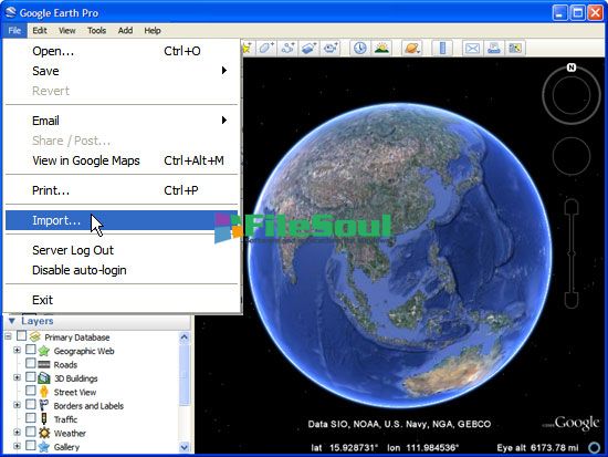
It is possible to annotate the map, send a satellite photo by e-mail or to make measurements to the nearest centimeter. Google Earth is now linked to Google Maps with a single click and user can also vary the lighting of a place based on time.
The application offers the possibility to connect a GPS to view the route and take advantage of specific data such as elevations, speed, etc.
- Title:
- Google Earth 6.0.2.2074
- File Size:
- 13.4 MB
- Requirements:
- Windows 2000 / XP / Vista / Windows7 / XP64 / Vista64 / Windows7 64 / Windows8 / Windows8 64
- Language:
- en-us
- License:
- Freeware
- Date Added:
- 29 Mar 2011
- Publisher:
- Homepage:
- http://www.google.com
- MD5 Checksum:
- C1A2762899C601BDD2CFC6332A86EFD4
* Issues Fixed with Desktop Client:
- Fixed a problem where we were over fetching certain kml layer data and running into issuing of using large amounts of memory and slowness during zooming in.
- Fixed an issue of ruler tool disappearing. In 6.0 beta, when measuring using the path tool, if you break to add a place-mark then you go back to the path and click "save" the path and ruler tool disappears all together.
- Fixed an issue with incorrectly measuring long distances. Improved navigation in Street View inside buildings.
- Fixed a crash with elevation profile if there was empty gx:value node in KML.
- Optimized amount of terrain and imagery data fetched while viewing photo overlays.
- Fixed an occasional crash while viewing 3D buildings. Fixed broken fly-to links within local kml files.
- Fixed an issue where new place-marks added were with absolute altitude instead of being clamped to ground.
- Fixed an issue where the title for panoramio pictures no longer appeared when hovering over panoramio icons with your mouse if scale legend was enabled.
- Fixed an issue when there was occasionally a missing wall in 3D buildings.
- Optimized amount of data fetched in Street View.
- Fixed an issue where tilt by holding “shift†and moving the scroll wheel only worked in one direction on Mac.
* Issues Fixed in Earth Browser Plug-in:
- Fixed a crash when getNormalStyleUrl was called on a StyleMap referencing a non-existent Style.
- Fixed some issues in using plug-in on https sites.
- Fixed functionality of disabling ground level navigation through API.
Screenshots
Related software
4.8/5 from 62 users