 Google Earth 6.1.0.5001
Google - (Freeware)
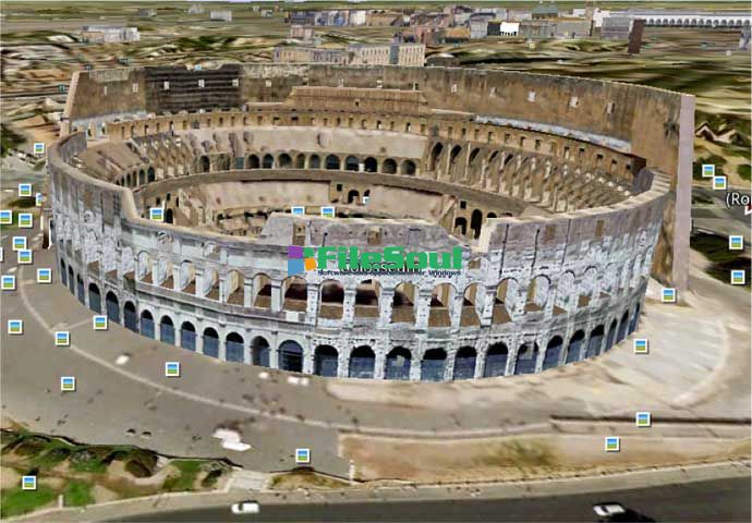
View 3D Earth, 3D representations of monuments, buildings, stars and satellites or just study the interactive globe with the amazing application called Google Earth.
Google Earth is a virtual globe that can be used to view the images recorded by satellite from most places in the world.
By entering the place to visit in the search, the application leads the user from space or a few meters above the ground, directly to destination. The accuracy of the photos is amazing.
Globe handling is very intuitive, being possible to orient the camera to rotate, move and naturally enlarge the image.
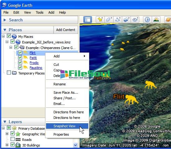
Additional information can be overlaid on the satellite image, such as hotels, restaurants, roads, etc.
Google Earth is entirely in 3D, relief areas (land and sea) and the buildings are also apparent.
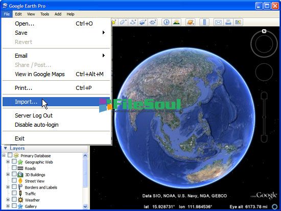
It is possible to annotate the map, send a satellite photo by e-mail or to make measurements to the nearest centimeter. Google Earth is now linked to Google Maps with a single click and user can also vary the lighting of a place based on time.
The application offers the possibility to connect a GPS to view the route and take advantage of specific data such as elevations, speed, etc.
- Title:
- Google Earth 6.1.0.5001
- File Size:
- 16.3 MB
- Requirements:
- Windows 2000 / XP / Vista / Windows7 / XP64 / Vista64 / Windows7 64 / Windows8 / Windows8 64
- Language:
- en-us
- License:
- Freeware
- Date Added:
- 21 Oct 2011
- Publisher:
- Homepage:
- http://www.google.com
- MD5 Checksum:
- 2A7FBD8F86EBD2754A50A1B972D76219
# Fixed bugs and product changes:
* To conform more closely with the OGC KML 2.2 standard, we've made the parsing of the <coordinates> tag more strict in version 6.1. Spaces must only be used to separate the (longitude,latitude,altitude) triplets which specify the coordinates of a single point. It is invalid to add spaces between individual coordinates. We understand that previous versions of the client were more lenient, so if your KML files contain spaces beween coordinates in coordinate triplets, an easy workaround is to remove all whitespace located immediately before or after commas inside a <coordinates> tag.
* Several performance improvements that would allow smoother experience in specific computer configurations.
* Fixed 'Restrict to View' functionality during a shapefile import in Google Earth Pro.
* Fixed an issue where Google Earth would sometimes save incorrect ordering of elements in KML.
* Added field of view recording to tours and ability to play back those changes.
* Fixed an issue where the icon heading did not work in Google Earth API.
* Changes to reduce occurrences of missing desktop icon and shortcut menu items on an update.
* Sped up overlay polygon rendering in OpenGL mode.
* Fixed loading of kmz files when the first file at the root level was image file.
* Upgraded GDAL support to 1.7.0 and fixed issues with importing .tab files in Google Earth Pro.
* Fixed the discrepancy caused in measurements due to multiple radii of Earth used inside Google Earth.
* Fixed an issue where placemarks created with UTM coordinates did not move when edited.
* Fixed an issue when screen overlays disappeared in a print-out.
Screenshots
Related software
4.8/5 from 62 users